Neus · Co. Donegal
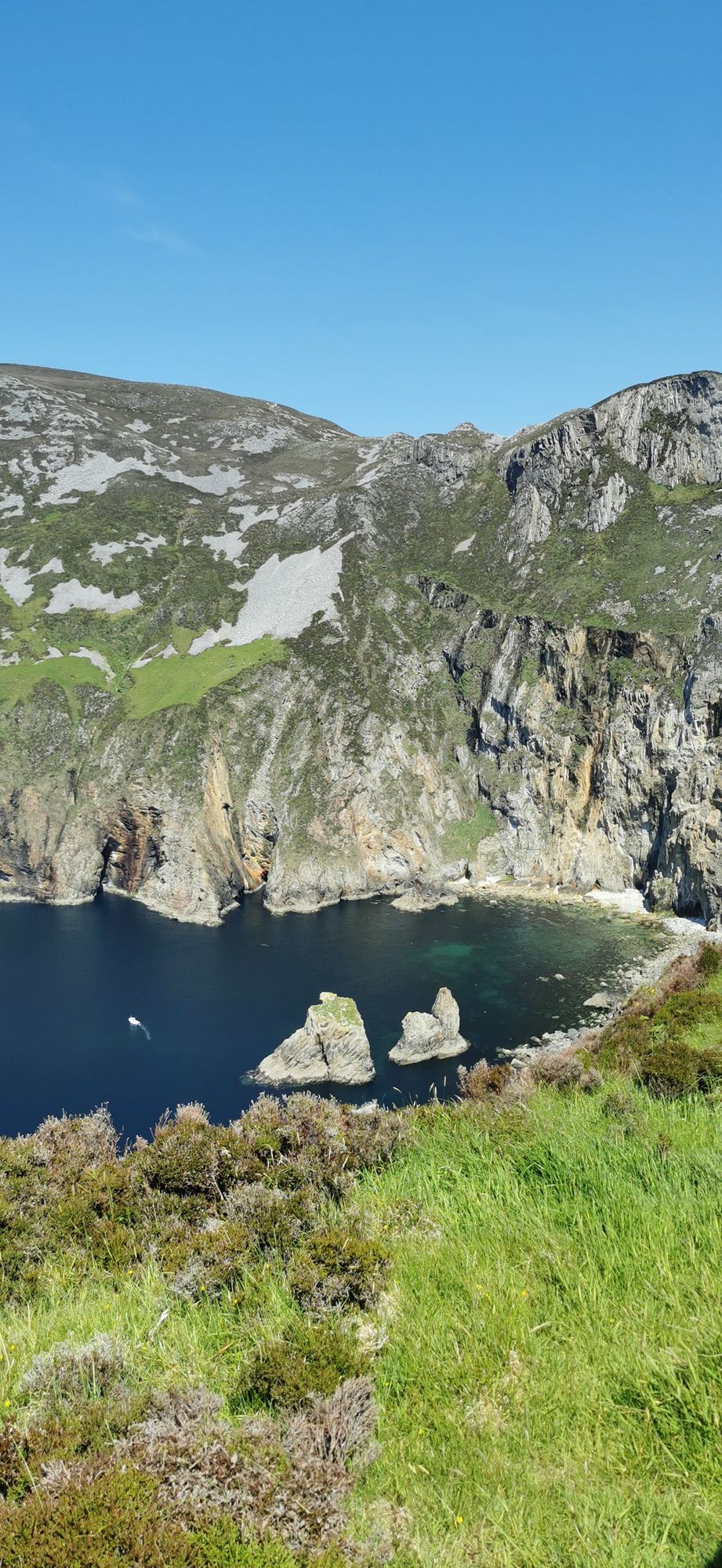
Slieve League
A wall of grey limestone dropping roughly 600 metres into the Atlantic on the Derrybeg Peninsula in southwest Donegal — among the highest sea cliffs in Europe, and only properly seen from the foot of them.
Streek · Co. Donegal
A large, remote mountain and glen country in southwest Donegal, centred on Derryveagh National Park — one of the wildest areas of lowland and mountain on the west coast.
Derryveagh is not a single place but a stretch of country: a range of mountains, a series of coastal glens, and a patchwork of bog, heather and conifer that runs from the townland of the park down to the sea. It is the largest mountain area in the northwest of Ireland, and a good part of it is protected as Derryveagh National Park, managed by the National Parks and Wildlife Service.
The name of the park and the area is a worn-down form of an older Irish name, and the country has been lived in for a very long time. There are ringforts, field systems and old ways through the glens, and the sense of a place that was worked and walked over for generations is strong here.
The coastal glens are the best-known part of the area. Glencolmcille is one of the most accessible, with a path down to the sea and a waterfall in the season. The glens are a good place for a long walk, and the sense of remoteness is real — there are few other people out, and the sound of the sea is usually not far away.
The mountain area rises to a series of peaks, and the highest points give wide views across the Donegal coast and, on a clear day, toward the Slieve League and Erris ranges. The ground is rough and the weather is quick, and the walks are for people who are used to the west coast.
The light is best in late summer and early autumn, when the heather is coming into colour and the days are still long. The glens are at their greenest in spring, and the mountain is most dramatic in a low, moving winter cloud.
Free to visit. There are a number of waymarked walks of varying length and difficulty; check the current status of any path before you set out, as some are closed in wet weather or for management reasons. The nearest village with basic services is Dungloe, about twenty minutes by car. There are no facilities in the park itself.
Waar logeren
Choose a nearby village as your base and leave enough time for the long roads, changing weather, and unhurried stops.
Bekijk de actuele beschikbaarheid voor je data. Beschikbaarheid en prijzen komen van de aanbieder, niet van ons.
A wall of grey limestone dropping roughly 600 metres into the Atlantic on the Derrybeg Peninsula in southwest Donegal — among the highest sea cliffs in Europe, and only properly seen from the foot of them.
The small town in south-west Donegal on the N56, named in 2012 by The Irish Times as the best village in which to live in Ireland — a proper base for the Bluestack country and the west coast.
The second-largest town in Donegal, on the Inishowen shore of Lough Swilly — the old O’Dohertys’ seat, O’Doherty’s Keep at the river mouth, and the town that the textile trade built up.
The surf town at the foot of the Doran River, listed by National Geographic in 2012 as one of the world’s top 20 surf towns — and the place where Mícheál Ó Cléirigh compiled the Annals of the Four Masters.