Landzunge · Co. Donegal
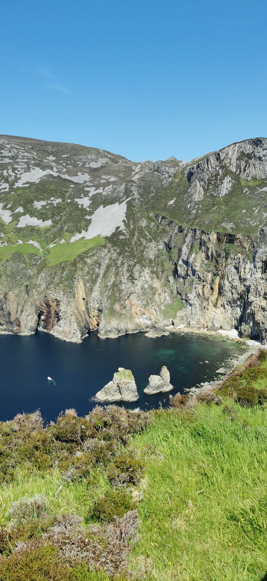
Slieve League
A wall of grey limestone dropping roughly 600 metres into the Atlantic on the Derrybeg Peninsula in southwest Donegal — among the highest sea cliffs in Europe, and only properly seen from the foot of them.
Grafenschaft · North Atlantic
A wall of grey limestone dropping roughly 600 metres into the Atlantic on the Derrybeg Peninsula in southwest Donegal — among the highest sea cliffs in Europe, and only properly seen from the foot of them.
The small town in south-west Donegal on the N56, named in 2012 by The Irish Times as the best village in which to live in Ireland — a proper base for the Bluestack country and the west coast.
The second-largest town in Donegal, on the Inishowen shore of Lough Swilly — the old O’Dohertys’ seat, O’Doherty’s Keep at the river mouth, and the town that the textile trade built up.
The surf town at the foot of the Doran River, listed by National Geographic in 2012 as one of the world’s top 20 surf towns — and the place where Mícheál Ó Cléirigh compiled the Annals of the Four Masters.
The Inishowen village on Trawbreaga Bay — the crossroads of the peninsula’s north coast, with the Atlantic beaches, the glens and the old fishing country all inside the hour.
A large, remote mountain and glen country in southwest Donegal, centred on Derryveagh National Park — one of the wildest areas of lowland and mountain on the west coast.
The wide north-west bay that three counties share — Donegal, Leitrim and Sligo — with the town of Donegal and the River Eske at its head and the open Atlantic at its back door.
A Gaeltacht village at the foot of Errigal in the Poisoned Glen, on the shore of Dunlewey Lough — boat trips from the lakeside centre, the castle ruins on the far shore, and Irish the working language of the street.
The headland above the small Inishowen settlement of Dunree, on the north-west coast — the cliff top, the short walk and the open Atlantic, with the lough behind it.
The 751-metre mountain above Gweedore — the highest peak in County Donegal and the southernmost of the Seven Sisters, with the Poisoned Glen at its foot and the whole Derryveagh country spread below it.
The small Atlantic district in the Gaeltacht named for Saint Columba — “the valley of Colm Cille” — with the village of Cashel, long sandy beaches and a coast that keeps its Irish.
The second-largest national park in Ireland — 170 square kilometres of the Derryveagh Mountains, Lough Veagh and the castle that Captain Adair built and the tenants lost.
A Gaeltacht village in the Cloughaneely district of north-west Donegal — three kilometres from Falcarragh, with the Errigal country behind it and Irish the everyday language.
The small village on the N56 midway between Donegal town and Killybegs — the crossroads of the south-west coast road, with the Bluestack country behind it and the bay in front.
One of only three glacial fjords in Ireland — the long sea inlet between Inishowen and the Fanad, with Buncrana and Rathmullan on its shores and Letterkenny at its head.
The northwestern tip of mainland Ireland, where the Wild Atlantic Way starts — a lighthouse, a tenth-century cross, and the widest view of two seas you will get on this coast.
The flat-topped mountain of the Derryveagh range — 667 m, second of the Seven Sisters — with a summit cairn over a Bronze Age court tomb and a quartz-mining history written into its northern face.
The Fanad Peninsula village where the Flight of the Earls began: on 14 September 1607 the Gaelic lords sailed from its quay, and the ruined 1516 Carmelite friary still stands in the village.
The small Gaeltacht village at the foot of Slieve League, at the north-west end of Donegal Bay — the natural start of the cliff walk and the last stop before the sea turns on you.
The Inishowen district five kilometres south of Buncrana, named for its patron saint Mura — an early Christian monastery, one of the great surviving cross-slabs, the marina and the forested river valley.
Monday 16 November 2026, 09:00