Neus · Co. Clare
Black Head
The north-western tip of County Clare, above Kilrush Bay at the entrance to Galway Bay — the headland that turns the coast, and the small 1936 lighthouse that the liners’ captains asked for.
Bouwstuk · Co. Clare
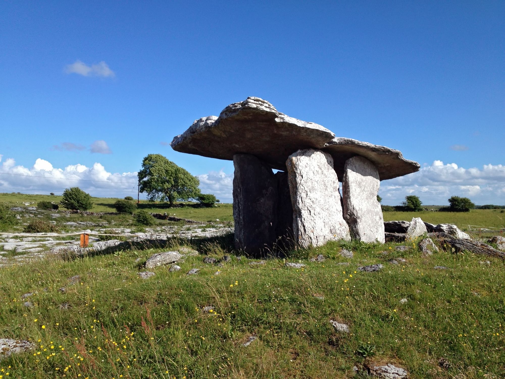
“The hole of the quernstone” — the best-known of Ireland’s roughly 172 dolmens, an early Neolithic portal tomb of 3800–3200 BC standing on the highest ground of the Burren, built on limestone laid down 350 million years ago.
Poulnabrone Dolmen, County Clare — photo by eyeem-4
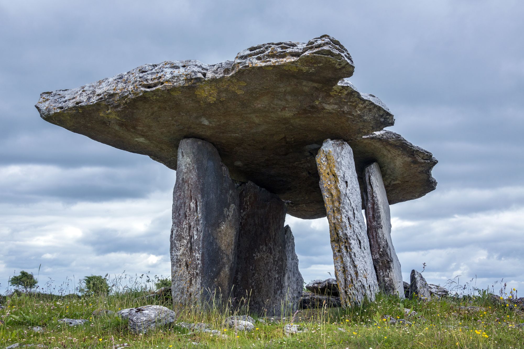
Poulnabrone dolmen (Poll na Brón in Irish, meaning “hole of the quernstone”) is a large dolmen — a cromlech, a type of single-chamber portal tomb — located in the Burren, County Clare, Ireland. It is situated on one of the region’s most desolate and highest points, and it comprises three standing portal stones supporting a heavy horizontal capstone. It dates to the early Neolithic period, with estimates from 3800 to 3200 BC. Although not the largest, it is the best known of the approximately 172 dolmens in Ireland.
The dolmen was constructed on a unique karst landscape formed from limestone laid down around 350 million years ago — the same Burren pavement that makes the whole of west Clare what it is. The dolmen was built by Neolithic farmers, choosing the location either for ritual, as a territorial marker, or as a collective burial site. What remains today is only the “stone skeleton” of the original monument: originally it would have been covered with soil, and its flagstone cap would have sat in a mound that is long since gone. The walk up to it is through the barest ground in the county, and the view from the top — over the Burren to the Atlantic — is part of the monument.
Poulnabrone is on the Burren’s highest ground, and the standard walk to it is the point of the trip: up from the car park through the karst pavement, past the lower monuments, to the dolmen on the ridge. Allow time for the climb and the view, and the weather on the Burren is the whole story — it changes fast, and the open ridge has no cover. Pair it with the wider Burren country for a full day.
Poulnabrone is in the Burren, a short drive from Doolin and Ennis; the walk to it is on open ground. The monument and the walk are managed as part of the Burren country — confirm the present access arrangements before travelling in wet weather.
Waar logeren
Doolin or Ennis put the dolmen, the pavement and the Atlantic all within a short drive.
Bekijk de actuele beschikbaarheid voor je data. Beschikbaarheid en prijzen komen van de aanbieder, niet van ons.
The north-western tip of County Clare, above Kilrush Bay at the entrance to Galway Bay — the headland that turns the coast, and the small 1936 lighthouse that the liners’ captains asked for.
“Rock of the fleet” — the fishing village at the mouth of the Moyarta, with the ruined castle that stood guard over the Shannon mouth, on the Loop Head peninsula’s estuary side.
The Atlantic music village of West Clare — four miles from the Cliffs of Moher, where the traditional sessions run nightly in the pubs and the harbour puts the boats out to the Arans.
“Diomán’s island” — the small market town on the Burren’s east edge, where the River Inagh runs its Cascades behind the main street and the bridge across the river leads to Lahinch.