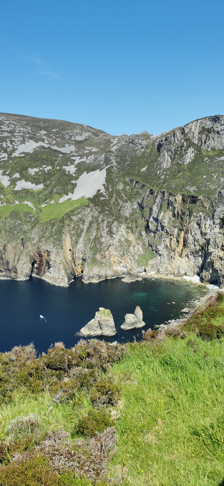
Landzunge · Co. Donegal
Slieve League
A wall of grey limestone dropping roughly 600 metres into the Atlantic on the Derrybeg Peninsula in southwest Donegal — among the highest sea cliffs in Europe, and only properly seen from the foot of them.
Dorf · Co. Donegal
The Fanad Peninsula village where the Flight of the Earls began: on 14 September 1607 the Gaelic lords sailed from its quay, and the ruined 1516 Carmelite friary still stands in the village.
Rathmullan sits on the western shore of Lough Swilly at the foot of the Fanad Peninsula, eleven kilometres north-east of Ramelton and twelve east of Milford. Its Irish name, Ráth Maoláin, means "Maolán's ringfort", and the country around the village carries the earliest settlement of all: court tombs and ringforts in the neighbouring townlands of Crevary Upper, Rathmullan and Ballyboe predate the rest of the site by a good few thousand years. The village keeps its history in the open — the quay, the friary and the lough views are all within a short walk of one another.
The ruined Carmelite friary dates from 1516 and was built by Eoghan Rua MacSweeney. It was sacked by an English garrison from Sligo in 1595, and in 1617 it was occupied by the Protestant Bishop of Raphoe, Andrew Knox. A later Bishop of Raphoe turned it into a fortified house in anticipation of a possible French invasion during the Napoleonic Wars. The walls are what remain, and the setting — above the village, with the lough beyond — is a good place to feel how that history happened rather than read about it.
On 14 September 1607, ninety-nine aristocrats of the Gaelic order, including chiefs of Clan Ó Néill and Clan Ó Domhnaill, left Rathmullan for the European continent in the episode now known as the Flight of the Earls — the turning point that closed an era in Irish history. The quay has marked the anniversary with commemorations, and the village's calendar still turns on that date.
The village makes the base for the Fanad Peninsula: the lighthouse at the head, the coastal walks and the view across to Inishowen are all an easy drive or a long walk from the centre. Allow half a day here.
Übernachten
Stay where the Flight of the Earls began — the Fanad villages are small and the light is big.
Aktuelle Verfügbarkeit für Ihre Reisedaten. Verfügbarkeit und Preise stammen vom Anbieter, nicht von uns.
A wall of grey limestone dropping roughly 600 metres into the Atlantic on the Derrybeg Peninsula in southwest Donegal — among the highest sea cliffs in Europe, and only properly seen from the foot of them.
A large, remote mountain and glen country in southwest Donegal, centred on Derryveagh National Park — one of the wildest areas of lowland and mountain on the west coast.
The northwestern tip of mainland Ireland, where the Wild Atlantic Way starts — a lighthouse, a tenth-century cross, and the widest view of two seas you will get on this coast.